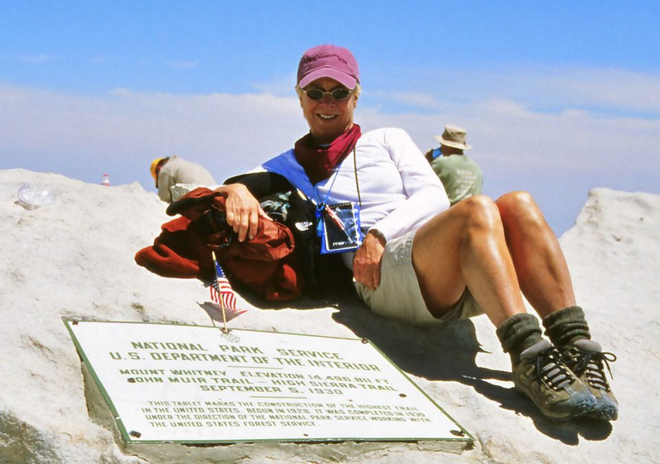
Everyone I talked to, including the guy bagging my groceries, had hiked Mount Whitney, 14,491 feet. Sure, it’s the highest peak in the lower forty-eight with well-marked routes. By some accounts, these trails are the most heavily traveled in the United States: Some 19,000 attempt Mt. Whitney from the east, an additional 4,000 climb from the west.
What made our effort unique was attempting the all-or-nothing 22-mile round-trip attack. A little voice in my head said, “Are out of your mind?” Another one, the louder one said, “Sounds cool. Let’s do it.”
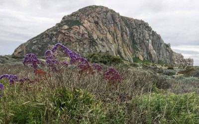
My friend Christine trained with me: Walking on the beach from Morro Bay Harbor to Cayucos Pier. I carried rocks in my pack to simulate tonnage, knowing a gallon of water weighs 8.34 pounds.
According to our calculations, we’d be in the oxygen-deprived altitude between 16-18 hours. That meant hitting the trailhead at Whitney Portal, 8,365 ft. at 4 a.m. with little light-emitting diodes (a tiny crystalline semiconducting device that glows brightly) strapped to our foreheads. We left as planned, only briefly pausing to scan a sign about bears, “Never underestimate an animal that can learn to ride a motorcycle. …”
Risking Bears and Thin Air
It seemed important to know what to do in the case of an encounter with an American Black Bear, although Ursus americanus seldom attacks humans. But here’s the thing. They can. And do. Since California has a large population of the 500-pound omnivores—between 30,000 and 40,000, according to estimates by Fish & Game—we needed a defense strategy.
Apparently, it is not uncommon for a Black Bear to display dominance in what’s called a “bluff charge.” If this happens, you’re supposed to make yourself look big. Open your jacket. Raise your arms. Yell.
If that doesn’t deter one of the largest terrestrial meat-eating creatures in North America, drop face down, tuck in a ball, clutch the back of your neck, and kiss your butt good-bye.
After rehashing the countless of ways we could to die up here, including Acute Mountain Sickness or AMS, we plodded along a needle-strewn trail over the biggest continuous block of granite on the planet, the Sierra Nevada Mountain Range, a geological spine formed over millions of years, running 430 miles.
Heading Into the Clouds
Mount Whitney, named for state geologist Josiah Dwight Whitney, rises on the east side of the Great Western Divide, a chain of mountains “dividing” the watersheds of two rivers: Kaweah to the west and the Kern to the east.
The first few miles were crisp in their greenness, ferns in every shade of the spectrum. Our beams bounced over enough wildflowers to exhaust the most ardent botanist: Indian paintbrush, alpine shooting star, penstemon, skunk cabbage, yarrow, and blue-pod lupine, the tallest and lushest western specie.
It was one of those can’t-beat-it mornings when you think you can hike forever. Even our time was faster than the expected 1 mile per hour. “I only went out for a walk and finally concluded to stay out till sundown,” John Muir wrote, “for going out, I found, was really going in.”
By 7:40 a.m., we were sweating and stopped to swap fleece-lined leggings for shorts. At 9,000 ft. we saw the first patches of snow, clinging to granite escarpments, tinged pink with algae. Around 10,500 ft. we bid farewell to trees and shade, sucking on the tube running from the water bladders in our packs to which we’d added an electrolyte replacement.
We filled up again at Trailside Meadow, 11,395 ft., where Lone Pine Creek gurgles through the last expanse of grasses, pumping water through a portable filter to keep out microorganisms, like Giardiasis. This nasty little parasite worms its way into your small intestine, causing cramps, abdominal swelling, nausea, vomiting, and diarrhea. No thanks.
The next section of trail was even rockier, gaining altitude at a steadily steeper rate, but professing exceptional views of Consultation Lake, Arc Pass, Mount McAddie, Mount Muir, and the massive east face of the Sierra Nevada, rugged and sheer. It was slow going.
My arm grazed a Winnebego-size chunk of granite splattered with crust like growths. “Alice Algae and Freddy Fungi took a lichen to each other,” I said. “They’ve been on the rocks ever since.”
Christine shot me a look. By then we both had pressure headaches, the first signs of AMS. We popped Ibuprofen. High Altitude Cerebral Edema or HACE lies at the “severely ill” end of the AMS spectrum. That’s when the brain swells and ceases to function properly. This is a bad thing to have happen. The High Altitude Medicine Guide is replete with Golden Rules: “It is OK to get altitude illness. It is not OK to die from it.” AMS is the main reason 67 percent of those attempting to summit Whitney fail.
We drained a Sports Toddy at Trail Camp, 12,039 ft., 6-plus miles into our trek, then aimed our boots at the switchbacks—97 to 99 depending on how you count—unrelenting in their ascent of 1,620 ft. in 2.2 miles or 736 ft. per mile.
Run-off from snowmelt streamed down the middle of the trail. Still, I felt good. Strong. Energized.
End of Part I. Part II will appear in next month’s issue.